

Marine heatwaves abate with the start of summer
For the first time in two years, New Zealand coastal waters are free of marine heatwaves. This is according to Moana Project scientists, who say that the marine heatwaves dissipated just before summer started when cooler weather caused a drop in sea surface temperatures.
The Moana Project started forecasting marine heatwaves in December 2020, and since then one part or other of the country’s coastal waters has always been under marine heatwave conditions.
That is until 25 November this year when sea surface temperatures suddenly dropped. Dr Joao de Souza from MetOcean Solutions explains: “We’ve seen colder waters just as summer started, with surface temperatures dropping from marine heatwave conditions around many parts of the country to temperatures nearer normal conditions.”
“The sharp drop in sea surface temperatures was likely caused by the cold, windy weather we’ve seen in many parts of the country over the last couple of weeks. This cooled down the surface water, bringing an end to sea surface marine heatwaves.”
However, Moana Project research shows that marine heatwaves persisted in many regions at depth, with sea temperatures reaching maximum levels below the sea surface.
Oceanographer Dr Rob Smith from Otago University explains: “In many areas, we see unusually warm water at depth. For example, offshore from the Bay of Plenty sea surface temperatures are close to normal but at 200m depth water temperatures are more than 2 degrees warmer than what they are supposed to be for this time of year.”
“For marine life, the temperature at depth, throughout the water column, is what is important,” adds Dr Souza. He also cautions that the dip in temperatures may be short-lived.
“Although there are no marine heatwaves right now, the sea surface temperatures around the country are still higher than average in many places. With settled weather and some sunshine, the marine heatwaves will likely reappear.”
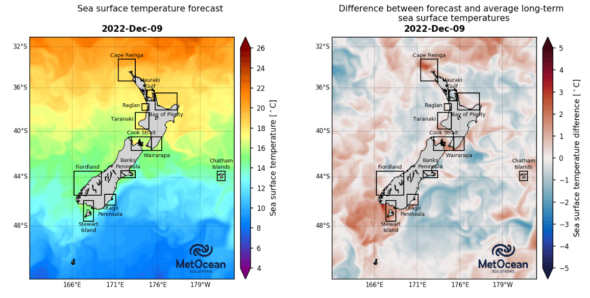
Today’s sea surface temperatures on the left, on the right the difference between today’s temperatures and the long term average, with red denoting warmer than average conditions and blue colder than average.